Ofbyld:Haarlem_centrum.png
From Wikipedia, the free encyclopedia
Grutte fan dit proefbyld: 540 × 599 piksels. Oare resolúsjes: 216 × 240 piksels | 432 × 480 piksels | 674 × 748 piksels.
Oarspronklik bestân (674 × 748 pixels, bestânsgrutte: 408 KB, MIME-type: image/png)
Dit bestân komt fan Wikimedia Commons, en kin ek troch oare projekten brûkt wurde. De beskriuwing op syn bestânsside dêre wurdt hjirûnder werjûn.
Gearfetting
| BeskriuwingHaarlem centrum.png |
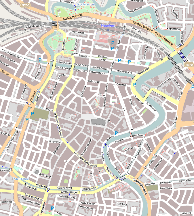
English: Map of Haarlem
Geographic limits of the map:
This file is licensed under the Creative Commons Attribution-Share Alike 2.0 Generic license.
|
| Datum | |
| Boarne | OpenStreetMap |
| Auteur | Jane023 (talk) 15:47, 27 January 2011 (UTC) |
Lisinsje
I, the copyright holder of this work, hereby publish it under the following license:
This file is licensed under the Creative Commons Attribution-Share Alike 3.0 Unported license.
- Fiel jo frij:
- te dielen – it wurk te kopiearjen, fersprieden en út te stjoeren
- te fermingen – it wurk oan te passen
- Under de neikommende betingsten:
- Nammefermelding – You must give appropriate credit, provide a link to the license, and indicate if changes were made. You may do so in any reasonable manner, but not in any way that suggests the licensor endorses you or your use.
- Lyk diele – If you remix, transform, or build upon the material, you must distribute your contributions under the same or compatible license as the original.
Captions
Add a one-line explanation of what this file represents
copyright status Ingelsk
copyrighted Ingelsk
inception Ingelsk
27 jan 2011
Triemskiednis
Klik op in datum/tiid om it bestân te besjen sa't it op dat stuit wie.
| Datum/Tiid | Miniatuer | ôfmjittings | Meidogger | Opmerking | |
|---|---|---|---|---|---|
| lêste | 27 jan 2011, 17.47 | | 674 × 748 (408 KB) | Jane023 | {{Information |Description={{en|1=Map of Haarlem Geographic limits of the map: * N: 52.39015° * S: 52.37407° * W: 4.62487° * E: 4.64933° {{CC-BY-SA 2.0}} }} |Source=[http://www.openstreetmap.org/?lat=52.38211&lon=4.6371&zoom=15&layers=M OpenStree |
Bestânsgebrûk
De neikommende 3 siden brûke dit bestân:
Globaal bestânsgebrûk
De neikommende oare wiki's brûke dit bestân:
- Gebrûk op ar.wikipedia.org
- Gebrûk op ca.wikipedia.org
- Gebrûk op ceb.wikipedia.org
- Gebrûk op en.wikipedia.org
- Teylers Museum
- Vleeshal
- Hofje van Bakenes
- Hofje van Noblet
- Frans Loenenhofje
- Lutherse Hofje
- Hofje van Staats
- Hofje van Loo
- Teylers Hofje
- Hofje In den Groenen Tuin
- Hofjes in Haarlem
- Wijnbergshofje
- Grote Markt (Haarlem)
- Vrouwe- en Antonie Gasthuys
- Hofje van Oorschot
- Module:Location map/data/Netherlands Haarlem/doc
- Johan Enschedé Hof
- Bakenesserkerk
- St. Barbara Gasthuis
- Module:Location map/data/Netherlands Haarlem
- Gebrûk op fa.wikipedia.org
- Gebrûk op fr.wikipedia.org
- Gebrûk op ig.wikipedia.org
- Gebrûk op kn.wikipedia.org
- Gebrûk op nl.wikipedia.org
- Teylers Museum
- Amsterdamse Poort (Haarlem)
- Frans Hals Museum
- Grote of Sint-Bavokerk
- Groenmarktkerk
- Vishal (Haarlem)
- Grote Markt (Haarlem)
- Hofje van Bakenes
- Brouwershofje
- Vrouwe- en Antonie Gasthuys
- Hofje van Noblet
- Frans Loenenhofje
- Verweyhal
- Bakenesserkerk
- Gravinnehof
- Synagoge (Haarlem)
- H.H. Anna en Mariakathedraal
- Sint Josephkerk (Haarlem)
- Verwey Museum Haarlem
- Hodshon Huis
Mear globaal gebrûk fan dit bestân besjen.
Opfrege fan "https://fy.wikipedia.org/wiki/Ofbyld:Haarlem_centrum.png"