קובץ:Ghaznavid_Empire_975_-_1187_(AD).PNG
ויקיפדיה האנציקלופדיה encyclopedia
אין גרסה ברזולוציה גבוהה יותר.
Ghaznavid_Empire_975_-_1187_(AD).PNG (620 × 428 פיקסלים, גודל הקובץ: 20 ק"ב, סוג MIME: image/png)
| זהו קובץ שמקורו במיזם ויקישיתוף. תיאורו בדף תיאור הקובץ המקורי (בעברית) מוצג למטה. |
תקציר
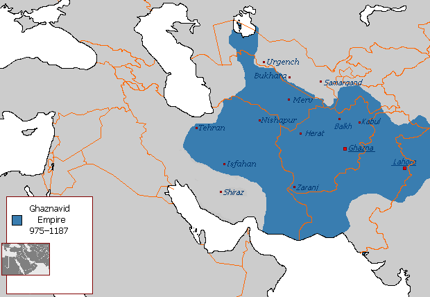
| תיאורGhaznavid Empire 975 - 1187 (AD).PNG |
Polski: Państwo Ghaznawidów
English: Ghaznavid Empire |
| תאריך יצירה | |
| מקור | נוצר על־ידי מעלה היצירה |
| יוצר | Arab League |
| גרסאות אחרות | Arabic |
-ar.PNG)
רישיון
| Public domainPublic domainfalsefalse |
| היצירה הזאת שוחררה לנחלת הכלל על־ידי היוצר שלה, Arab League מוויקיפדיה האנגלית. זה תקף בכל העולם. יש מדינות שבהן הדבר אינו אפשרי על פי חוק, אם כך: Arab League מעניק לכל אחד את הזכות להשתמש ביצירה הזאת לכל מטרה, ללא שום תנאי, אלא אם כן תנאים כאלה נדרשים לפי החוק.Public domainPublic domainfalsefalse |
כיתובים
נא להוסיף משפט שמסביר מה הקובץ מייצג
نقشهٔ قلمروی دودمان غزنویان
פריטים שמוצגים בקובץ הזה
מוצג
29 באוגוסט 2007
היסטוריית הקובץ
ניתן ללחוץ על תאריך/שעה כדי לראות את הקובץ כפי שנראה באותו זמן.
| תאריך/שעה | תמונה ממוזערת | ממדים | משתמש | הערה | |
|---|---|---|---|---|---|
| נוכחית | 07:54, 7 ביולי 2015 | | 428 × 620 (20 ק"ב) | HistoryofIran | Of course Iranica doesn't, it states which areas they ruled at their extent, stop making reverts without discussing.. |
| 04:05, 4 ביולי 2015 |  | 428 × 619 (21 ק"ב) | Persia10101 | More accurate map after some research | |
| 04:05, 4 ביולי 2015 |  | 428 × 619 (21 ק"ב) | Persia10101 | More accurate map after some research | |
| 03:58, 4 ביולי 2015 |  | 428 × 620 (26 ק"ב) | Persia10101 | Iranica doesnt show a map. reverting to the more commonly agreed map | |
| 03:57, 4 ביולי 2015 |  | 428 × 620 (26 ק"ב) | Persia10101 | Reverted to version as of 08:05, 14 August 2011 | |
| 15:08, 9 במאי 2014 |  | 428 × 620 (20 ק"ב) | HistoryofIran | Further fixed the map, i will be adding vassals later. | |
| 02:47, 29 בינואר 2014 |  | 428 × 620 (20 ק"ב) | HistoryofIran | Fars and Kerman remained under Buyid rule until the Seljuqs came. | |
| 18:01, 7 ביוני 2013 |  | 428 × 620 (20 ק"ב) | HistoryofIran | Fixed the map, according to Iranica the map was like this at it's greatest extent. | |
| 17:58, 7 ביוני 2013 |  | 428 × 620 (20 ק"ב) | HistoryofIran | Fixed the map, according to Iranica the map was like this at it's greatest extent. | |
| 17:54, 7 ביוני 2013 |  | 428 × 620 (20 ק"ב) | HistoryofIran | Fixed the map, according to Iranica the map was like this at it's greatest extent. |
שימוש בקובץ
הדף הבא משתמש בקובץ הזה:
שימוש גלובלי בקובץ
אתרי הוויקי השונים הבאים משתמשים בקובץ זה:
- שימוש באתר arz.wikipedia.org
- שימוש באתר ast.wikipedia.org
- שימוש באתר av.wikipedia.org
- שימוש באתר azb.wikipedia.org
- שימוש באתר az.wikipedia.org
- שימוש באתר ba.wikipedia.org
- שימוש באתר be.wikipedia.org
- שימוש באתר bg.wikipedia.org
- שימוש באתר bn.wikipedia.org
- שימוש באתר ca.wikipedia.org
- שימוש באתר ceb.wikipedia.org
- שימוש באתר ckb.wikipedia.org
- שימוש באתר da.wikipedia.org
- שימוש באתר de.wikipedia.org
- שימוש באתר el.wikipedia.org
- שימוש באתר en.wikipedia.org
- Muslim conquests of Afghanistan
- History of Afghanistan
- Turkic peoples
- Greater Iran
- Jasrota
- User:Arab Hafez/Map
- Portal:Afghanistan
- Shia Islam in the Indian subcontinent
- User:Ottava Rima/Persian Empire
- User:Sobreira/Religion
- Muslim conquest of Khorasan
- Nurpur kingdom
- User:Northamerica1000/Portals of the world
- User:Kansas Bear/Ghaznavids
- User:Kypioys sx/sandbox
- User:Kansas Bear/Saffarid dynasty
- שימוש באתר eo.wikipedia.org
- שימוש באתר es.wikipedia.org
.PNG)
מטא־נתונים
קובץ זה מכיל מידע נוסף, שכנראה הגיע ממצלמה דיגיטלית או מסורק שבהם הקובץ נוצר או עבר דיגיטציה.
אם הקובץ שונה ממצבו הראשוני, כמה מהנתונים להלן עלולים שלא לשקף באופן מלא את הקובץ הנוכחי.
| רזולוציה אופקית | 28.35 dpc |
|---|---|
| רזולוציה אנכית | 28.35 dpc |
.PNG)