Restren:Normandy_map.png
From Wikipedia, the free encyclopedia
Myns an ragwel ma: 800 × 571 piksel. Klerderyow erel: 320 × 229 piksel | 640 × 457 piksel | 1,024 × 731 piksel | 1,280 × 914 piksel | 1,966 × 1,404 piksel.
Restren wreydhek (1,966 × 1,404 piksel, myns an restren: 238 KB, eghen MIME: image/png)
| Restren dhyworth Wikimedia Commons yw hebma. Yma diskwedhys a-woles derivadow dhyworth y folen deskrifans ena. | Mos dhe folen an restren war Wikimedia Commons |

|
This locator map image could be re-created using vector graphics as an SVG file. This has several advantages; see Commons:Media for cleanup for more information. If an SVG form of this image is available, please upload it and afterwards replace this template with
{{vector version available|new image name}}.
It is recommended to name the SVG file “Normandy map.svg”—then the template Vector version available (or Vva) does not need the new image name parameter. |
Berrskrif
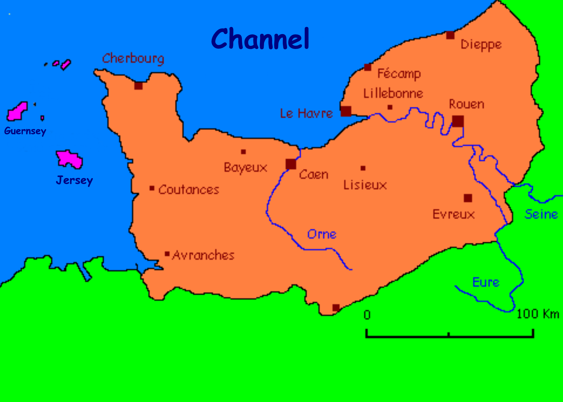
Carte présentant quelques villes normandes/ Carte réalisée par l'utilisateur fr:Utilisateur:Urban
Anglicised by User:Man vyi
derivative works
Derivative works of this file: Lassy in Normandy.jpg
Leshyans

|
Permission is granted to copy, distribute and/or modify this document under the terms of the GNU Free Documentation License, Version 1.2 or any later version published by the Free Software Foundation; with no Invariant Sections, no Front-Cover Texts, and no Back-Cover Texts. A copy of the license is included in the section entitled GNU Free Documentation License.http://www.gnu.org/copyleft/fdl.htmlGFDLGNU Free Documentation Licensetruetrue |
| Yma an restren ma yn-dann an leshyans Creative Commons Attribution-Share Alike 3.0 Unported. | ||
| ||
| This licensing tag was added to this file as part of the GFDL licensing update.http://creativecommons.org/licenses/by-sa/3.0/CC BY-SA 3.0Creative Commons Attribution-Share Alike 3.0truetrue |
| Annotations InfoField | This image is annotated: View the annotations at Commons |
1249
456
20
20
2048
1470
Honfleur
Captions
Add a one-line explanation of what this file represents
Карта Нормандии
Items portrayed in this file
depicts Sowsnek
copyright status Sowsnek
copyrighted Sowsnek
Istori an restren
Klyckyewgh war dhedhyans/eur rag gweles an folen dell o an termyn na.
| Dedhyans/Eur | Skeusennik | Mynsow | Devnydhyer | Kampol | |
|---|---|---|---|---|---|
| a-lemmyn | 22:40, 8 Metheven 2010 | | 1,966 × 1,404 (238 KB) | Ras67 | cropped |
| 07:10, 8 Du 2005 |  | 2,048 × 1,470 (265 KB) | Man vyi | Carte présentant quelques villes normandes/ Carte réalisée par l'utilisateur fr:Utilisateur:Urban Anglicised by User:Man vyi Category:Normandy |
Devnydh an restren
Yma an folen a syw owth usya an restren ma:
Devnydh ollvysel an restren
Yma an wikis erel a syw ow tevnydhya an restren ma:
- Devnydh war ang.wikipedia.org
- Devnydh war an.wikipedia.org
- Devnydh war ar.wikipedia.org
- Devnydh war ast.wikipedia.org
- Devnydh war azb.wikipedia.org
- Devnydh war az.wikipedia.org
- Devnydh war be-tarask.wikipedia.org
- Devnydh war be.wikipedia.org
- Devnydh war ca.wikipedia.org
- Devnydh war de.wikipedia.org
- Devnydh war en.wikipedia.org
- Devnydh war eo.wikipedia.org
- Devnydh war es.wikipedia.org
- Devnydh war eu.wikipedia.org
- Devnydh war fa.wikipedia.org
- Devnydh war fy.wikipedia.org
- Devnydh war he.wikipedia.org
- Devnydh war hy.wikipedia.org
- Devnydh war id.wikipedia.org
- Devnydh war ja.wikipedia.org
- Devnydh war jv.wikipedia.org
- Devnydh war kk.wikipedia.org
- Devnydh war lv.wikipedia.org
- Devnydh war mn.wikipedia.org
- Devnydh war mr.wikipedia.org
- Devnydh war nds.wikipedia.org
- Devnydh war nn.wikipedia.org
- Devnydh war ru.wikipedia.org
- Devnydh war ru.wiktionary.org
- Devnydh war sco.wikipedia.org
- Devnydh war sk.wikipedia.org
- Devnydh war ta.wikipedia.org
- Devnydh war tl.wikipedia.org
- Devnydh war tr.wikipedia.org
- Devnydh war ug.wikipedia.org
- Devnydh war uk.wikipedia.org
- Devnydh war vec.wikipedia.org
- Devnydh war wa.wikipedia.org
- Devnydh war zh-min-nan.wikipedia.org
Gweles devnydh ollvysel moy a'n restren ma.