Talaksan:Normandy_map.png
From Wikipedia, the free encyclopedia
Buong resolusyon ((1,966 × 1,404 pixel, laki ng talaksan: 238 KB, uri ng MIME: image/png))
|
|
Ito ay isang talaksan mula sa Wikimedia Commons. Makikita sa ibaba ang impormasyon mula sa pahina ng paglalarawan nito roon. |

|
This locator map image could be re-created using vector graphics as an SVG file. This has several advantages; see Commons:Media for cleanup for more information. If an SVG form of this image is available, please upload it and afterwards replace this template with
{{vector version available|new image name}}.
It is recommended to name the SVG file “Normandy map.svg”—then the template Vector version available (or Vva) does not need the new image name parameter. |
Buod
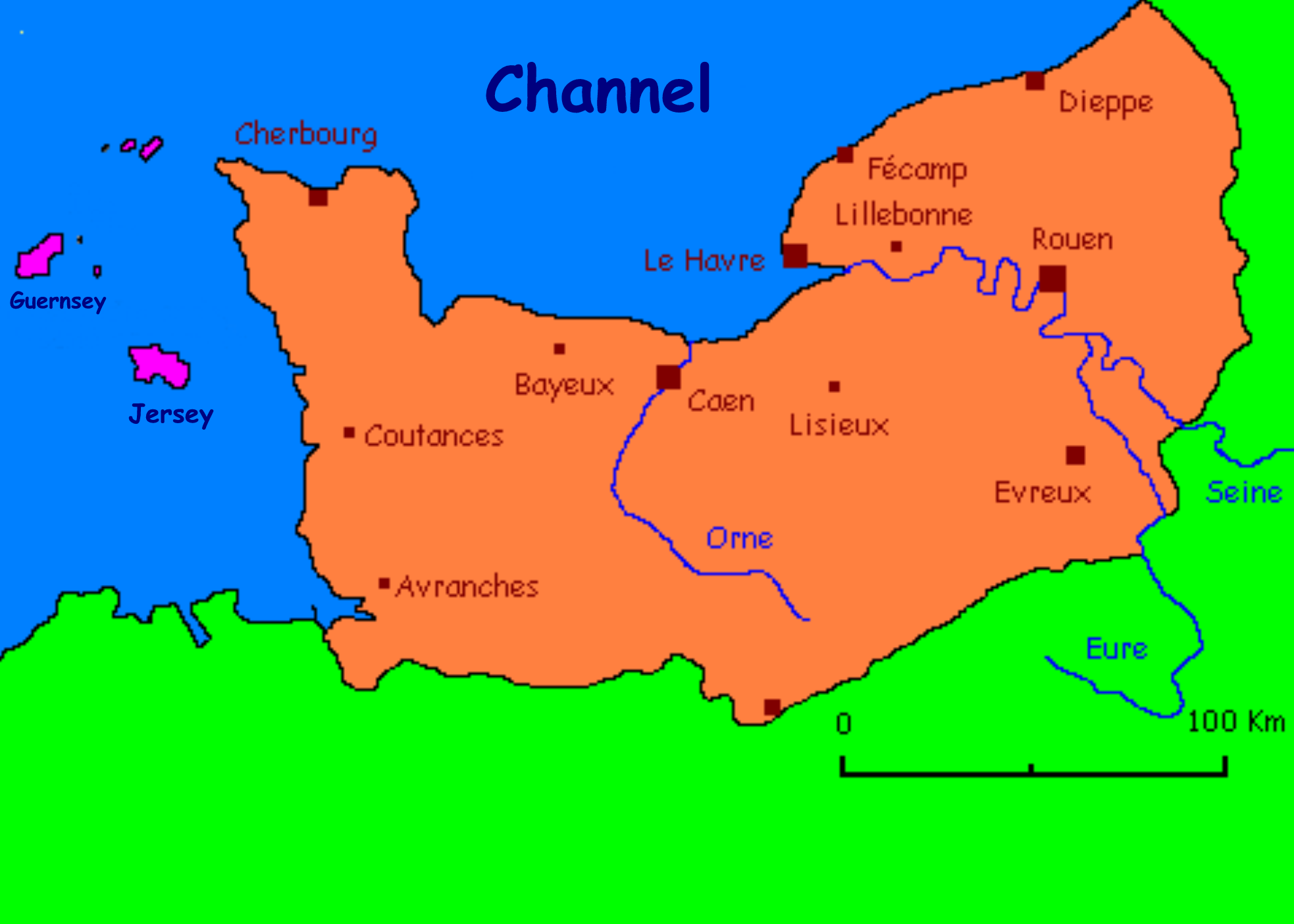
Carte présentant quelques villes normandes/ Carte réalisée par l'utilisateur fr:Utilisateur:Urban
Anglicised by User:Man vyi
derivative works
Derivative works of this file: Lassy in Normandy.jpg
Paglilisensiya

|
Pinapayagan ang pagkopya, pamamahagi, at/o pagbabago sa dokumentong ito sa ilalim ng mga nakasaad sa GNU Free Documentation License, Bersyon 1.2 o kahit anong mas bagong bersyong nilathala ng Free Software Foundation; nang walang pabago-bagong bahagi, walang teksto sa front-cover, at walang teksto sa back-cover. May nakalagay na kopya ng lisensiya sa bahaging pinamagatang GNU Free Documentation License.http://www.gnu.org/copyleft/fdl.htmlGFDLGNU Free Documentation Licensetruetrue |
| Lisensyado ang file na ito sa ilalim ng lisensiyang Creative Commons Attribution-Share Alike 3.0 Unported. | ||
| ||
| Ang tatak ng paglilisensiya ay idinagdag sa talaksang ito bilang bahagi ng pagsasapanahon ng paglilinsensiya ng GFDL .http://creativecommons.org/licenses/by-sa/3.0/CC BY-SA 3.0Creative Commons Attribution-Share Alike 3.0truetrue |
| Annotations InfoField | This image is annotated: View the annotations at Commons |
Honfleur
Captions
Items portrayed in this file
depicts English
copyright status English
copyrighted English
Nakaraan ng file
Pindutin ang araw/oras upang makita kung papaano ang itsura ng talaksan noong oras na iyon.
| Araw/Oras | Thumbnail | Mga dimensiyon | tagagamit | Kumento | |
|---|---|---|---|---|---|
| ngayon | 22:40, 8 Hunyo 2010 | | 1,966 × 1,404 (238 KB) | Ras67 | cropped |
| 07:10, 8 Nobyembre 2005 |  | 2,048 × 1,470 (265 KB) | Man vyi | Carte présentant quelques villes normandes/ Carte réalisée par l'utilisateur fr:Utilisateur:Urban Anglicised by User:Man vyi Category:Normandy |
Mga ugnay
Nakaturo sa talaksan na ito ang mga sumusunod na mga pahina:
Pandaigdigang paggamit sa file
Ginagamit ng mga sumusunod na wiki ang file na ito:
- Paggamit sa ang.wikipedia.org
- Paggamit sa an.wikipedia.org
- Paggamit sa ar.wikipedia.org
- Paggamit sa ast.wikipedia.org
- Paggamit sa azb.wikipedia.org
- Paggamit sa az.wikipedia.org
- Paggamit sa be-tarask.wikipedia.org
- Paggamit sa be.wikipedia.org
- Paggamit sa ca.wikipedia.org
- Paggamit sa de.wikipedia.org
- Paggamit sa en.wikipedia.org
- Paggamit sa eo.wikipedia.org
- Paggamit sa es.wikipedia.org
- Paggamit sa eu.wikipedia.org
- Paggamit sa fa.wikipedia.org
- Paggamit sa fy.wikipedia.org
- Paggamit sa he.wikipedia.org
- Paggamit sa hy.wikipedia.org
- Paggamit sa id.wikipedia.org
- Paggamit sa ja.wikipedia.org
- Paggamit sa jv.wikipedia.org
- Paggamit sa kk.wikipedia.org
- Paggamit sa kw.wikipedia.org
- Paggamit sa lv.wikipedia.org
- Paggamit sa mn.wikipedia.org
- Paggamit sa mr.wikipedia.org
- Paggamit sa nds.wikipedia.org
- Paggamit sa nn.wikipedia.org
- Paggamit sa ru.wikipedia.org
- Paggamit sa ru.wiktionary.org
- Paggamit sa sco.wikipedia.org
- Paggamit sa sk.wikipedia.org
- Paggamit sa ta.wikipedia.org
- Paggamit sa tr.wikipedia.org
- Paggamit sa ug.wikipedia.org
- Paggamit sa uk.wikipedia.org
- Paggamit sa vec.wikipedia.org
- Paggamit sa wa.wikipedia.org
- Paggamit sa zh-min-nan.wikipedia.org
Tingnan ang karagdagang pandaigdigang paggamit sa file na ito.